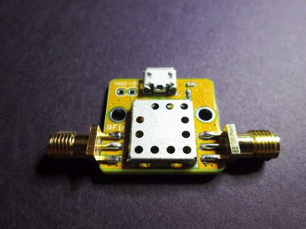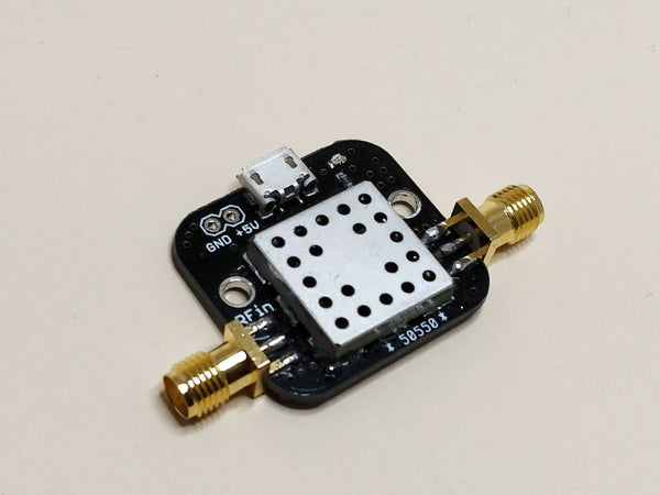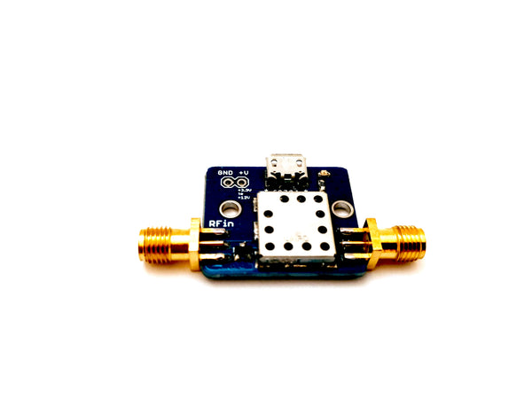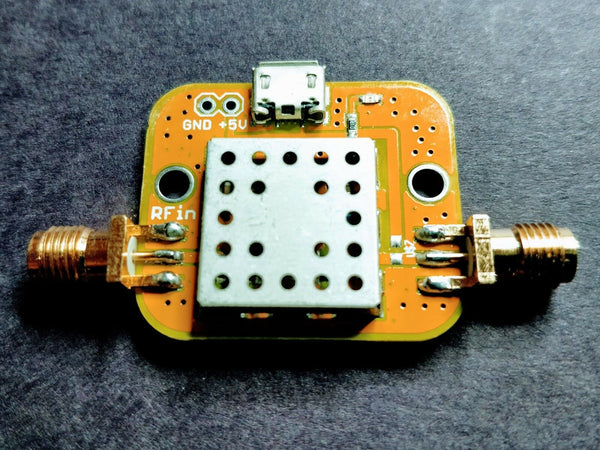


PRODUCT OVERVIEW
This is a small, Pre-Filtered GNSS Low Noise Amplifier. It covers the following technologies:
- GPS L1-L5
- BeiDou COMPASS
- GLONASS
- NAVIC
The LNA has an average gain of 25 dB in the pass band and Noise Figure of 1 dB. This product has excellent out-of-band rejection specifications, provides power handling of up to a maximum -15 dBm and has an operating temperature range of -40C to +85C.
The part can be powered using one of three different methods
- Micro-USB cable
- +5VDC to +12VDC to the DC header.
- Bias Tee with a voltage range of +5VDC to +12VDC
Please note the following precaution: Since the Bias Tee is installed. When powering the device using either the DC header or the USB connector, +5 VDC will appear on the RF output. If your receiver does not have a DC blocking capacitor on its input or some other form of DC voltage protection, this voltage WILL damage your receiver.
This is the equivalent product without a bias tee
APPLICATIONS
• GNSS signal reception in a weak signal environment
• Rejection of strong signals in Cellular, LTE, UHF and 915 MHz, 2.4 GHz ISM bands
• GNSS signal processing
SPECIFICATIONS
Passband
1100 MHz - 1700 MHz
Frequency ........... Gain
100 MHz ......... -2 dB
200 MHz ......... 3 dB
500 MHz ......... 10 dB
900 MHz ......... -2 dB
1000 MHz ......... -2 dB
1100 MHz ......... 30 dB
1200 MHz ......... 28 dB
1300 MHz ......... 26 dB
1400 MHz ......... 25 dB
1500 MHz ......... 25 dB
1600 MHz ......... 24 dB
1700 MHz ......... 24 dB
1800 MHz ......... 18 dB
1900 MHz ......... 6 dB
2000 MHz ......... -10 dB
2400 MHz ......... -5 dB
3000 MHz ......... -10 dB
NOTES
The filter uses SMA-F connectors.
This item can be powered using DC on the RF cable.
Max RF Input = -15 dBm
RELATED PRODUCTS
BANDS COVERED
GPS (USA)
| Frequency | Name | Use |
|---|---|---|
| 1575.42 MHz | L1 | Civil (C/A code), military (P(Y) code) |
| 1227.60 MHz | L2 | Military P(Y), civilian L2C |
| 1381.05 MHz | L3 | Nuclear detonation detection |
| 1379.91 MHz | L4 | Experimental ionospheric research |
| 1176.45 MHz | L5 | Safety-of-life, high accuracy civil |
GLONASS (Russia)
| Band | Frequency Range | Use |
|---|---|---|
| 1598.0625–1605.375 MHz | L1 (G1) | Civil standard |
| 1242.9375–1248.625 MHz | L2 (G2) | Civil/military |
| 1202.025 MHz | L3 (G3) | CDMA, interoperability with GPS L5 |
Galileo (EU)
| Frequency | Name | Use |
|---|---|---|
| 1575.42 MHz | E1 | Open service, shared with GPS L1 |
| 1191.795 MHz | E5 | Broadband, highest accuracy civil signal |
| 1176.45 MHz | E5a | Open service, interoperable with GPS L5 |
| 1207.14 MHz | E5b | Open service, high integrity |
| 1278.75 MHz | E6 | Commercial/authenticated service (HAS) |
BeiDou (China)
| Frequency | Name | Use |
|---|---|---|
| 1561.098 MHz | B1I | Legacy open service (BDS-2) |
| 1575.42 MHz | B1C | Modern open service (BDS-3), interop with GPS L1/Galileo E1 |
| 1176.45 MHz | B2a | Open service (BDS-3), interop with GPS L5/Galileo E5a |
| 1207.14 MHz | B2b | Open service (BDS-3), PPP service |
| 1191.795 MHz | B2 (B2a+B2b) | Wideband, same center as Galileo E5 |
| 1268.52 MHz | B3I | Authorized service |
NavIC (India)
| Frequency | Name | Use |
|---|---|---|
| 1176.45 MHz | L5 | Standard positioning service |
QZSS (Japan)
| Frequency | Name | Use |
|---|---|---|
| 1575.42 MHz | L1 | Interoperable with GPS L1 |
| 1227.60 MHz | L2 | Interoperable with GPS L2 |
| 1176.45 MHz | L5 | Interoperable with GPS L5 |
| 1278.75 MHz | L6 (LEX) | Centimeter-level augmentation (CLAS service) |
You might also like